Google AI model mines trillions of images to create maps of Earth ‘at any place and time’

The system will save time spent on processing satellite data, researchers say — but they hope the tech firm will share more about how it works
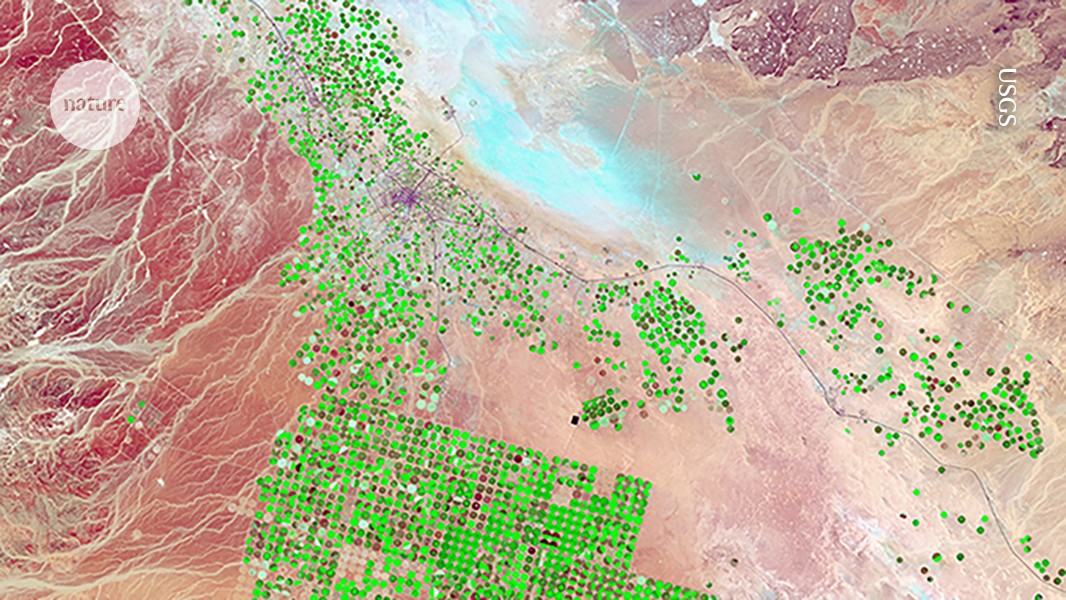
The AI system AlphaEarth Foundations integrates satellite images, such as this one of irrigated cropland, with other types of map to offer a data-rich picture of Earth.Credit: USGS
The technology giant Google has released an artificial intelligence (AI) model that acts as a ‘virtual satellite’ to weave together trillions of disparate observations — satellite images, radar and more — to track changes in land and shallow waters across Earth. Researchers are lauding the sheer scale of the effort while also calling on Google for more information about its tests, and warning that it will be up to individual scientists to verify any maps they obtain from the tool.
The model, called AlphaEarth Foundations, maps the world “at any place and time”, Christopher Brown, a research engineer at Google DeepMind in New York City, said at a press briefing on 28 July. Scientists might use it to identify the best places for clean-energy projects, study the ecological impacts of climate change, track deforestation and more.
Alongside the model, which was released yesterday, Google and its DeepMind AI unit have posted a paper, ahead of peer review, to the arXiv preprint server1. The manuscript describes the creation of the model, its initial testing and baseline data sets covering Earth during the years 2017–24. It says that AlphaEarth beats similar AI models in terms of both accuracy and data density, and that the model saves users computing time and reduces energy use.
Nicholas Murray, a conservation biologist at James Cook University in Townsville, Australia, is the lead scientist for Global Ecosystems Atlas, an initiative to map the world’s biodiversity and environments. Murray says that his team often spends “tens to hundreds of days” processing satellite data before it can even begin to make products such as maps describing changes in tidal wetlands over time. He hopes that Google’s latest model — which the team is familiar with — will make that process more efficient.
Packaging the data
Moving forward, Google says, it will regularly update AlphaEarth’s data sets, which come fully processed. They are available through the company’s Earth Engine, a cloud-based platform that already hosts separate repositories of data covering topics such as agriculture, deforestation and weather. AlphaEarth weaves together many of these data sets to create an integrated product that scientists can explore more easily.
Enjoying our latest content?
Login or create an account to continue
- Access the most recent journalism from Nature's award-winning team
- Explore the latest features & opinion covering groundbreaking research
or
Sign in or create an account Continue with Google
 Continue with ORCiD
doi: https://doi.org/10.1038/d41586-025-02412-1
This story originally appeared on: Nature - Author:Jeff Tollefson


